April 15, 2012 marked the 100th anniversary of the sinking of Titanic.
In August 2010, Jim participated in the most technologically-advanced field expedition to map Titanic. As the principal archaeologist on the wreck, during his tenure as Director of Maritime Heritage at NOAA (2010-2017), he was responsible for writing the archaeological report and site plan.
See media mentions and more below.

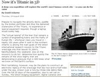
Excerpts: At 2:20 a.m. on April 15, 1912, the “unsinkable” R.M.S.Titanic disappeared beneath the waves, taking with her 1,500 souls. One hundred years later, new technologies have revealed the most complete—and most intimate—images of the famous wreck.
“This is a game-changer,” says National Oceanic and Atmospheric Administration (NOAA) archaeologist James Delgado, the expedition’s chief scientist. “In the past, trying to understand Titanicwas like trying to understand Manhattan at midnight in a rainstorm—with a flashlight.
Written by Jim for Archaeology Magazine
Excerpt: In 2010 two highly sophisticated robotic vehicles systematically crisscrossed the seabed on their own, with high-resolution sonar and camera systems, creating the first comprehensive map of the Titanic site. Another robot, at the end of a fiber-optic cable, sent to the surface live, full-color, 3-D images, allowing scientists to virtually walk the decks of the ship. This latest research effort, of which I was a part, represents a paradigm shift in underwater archaeology. For the first time, Titanic can be treated and explored like any other underwater site—even extreme depth is no longer an obstacle to archaeology. Thanks to rapid technological advances and interdisciplinary work, archaeologists have a whole new perspective on sites such as Titanic, and new questions to ask, questions we never could have dreamed of when underwater archaeology began just 50 years ago.
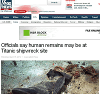
Excerpt: A 2004 photograph, released to the public for the first time this week in an uncropped version to coincide with the disaster’s centenary, shows a coat and boots in the mud at the legendary shipwreck site.
“These are not shoes that fell out neatly from somebody’s bag right next to each other,” James Delgado, the director of maritime heritage at the National Oceanic and Atmosphere Administration, told The Associated Press in a phone interview.

A Fragile Tourist Attraction on the Ocean Floor
Excerpts: Explorers and United States government experts have put together the first comprehensive map of the Titanic’s resting place, illuminating a square mile of inky seabed as a guide to better understanding the liner’s death throes and better preserving its remains.
“People have the right to see, explore and learn,” said James P. Delgado, director of maritime heritage at the National Oceanic and Atmospheric Administration, which monitors the wreck. “But you want to put down guidelines like those at Gettysburg and the Acropolis, so visitors can experience it in the same way.”
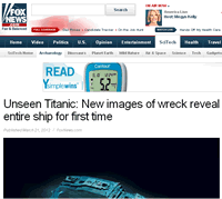
Excerpts: New images of the wreck of the RMS Titanic reveal for the first time ever the full stretch of the “unsinkable” boat — sprawled silently 12,500 feet beneath the Atlantic Ocean.
“This is a game-changer,” National Oceanic and Atmospheric Administration (NOAA) archaeologist James Delgado, the expedition’s chief scientist, told National Geographic. “In the past, trying to understand Titanic was like trying to understand Manhattan at midnight in a rainstorm—with a flashlight.”

The mission will use underwater robots to take 3-D measurements and construct a comprehensive picture of the famous wreck
Excerpt: Debris from the luxury liner, which sank nearly 100 years ago, is spread over a sprawling underwater site measuring about three-by-five kilometres. The mission will use underwater robots to take three-dimensional measurements and construct a view of the wreck.
“It would be as if you went to the side of the freeway in the aftermath of a car wreck, and everything is spread out,” Mr. Delgado, a maritime archeologist, said on Sunday from the bridge of the Jean Charcot. “Imagine then that after nearly 100 years, it’s still there, untouched.”
In new approach to Titanic, an exhibitor aids scientists
Excerpt: The voyage was prompted by a change of management at R.M.S. Titanic, which has been arguing in court for 17 years to be granted ownership of the artifacts it collected after 1987 or to be compensated for salvaging them. Rather than battle the archaeologists, the company’s new management met with a group of them over a year ago and learned that carefully mapping the wreckage site was the scientific community’s priority.
“A lot of decisions in the past have been decided by a court saying you need to go and pick up things in order to maintain sovereign possession,” said James P. Delgado, the president and chief executive of the Institute of Nautical Archaeology, a former critic of the company whose group is participating in this trip. “The level of intervention in the site in the future needs to be dictated by hard science.”
A deep-sea expedition will explore the world’s most famous wreck site – so you can do the same
Excerpt: While the main purpose of the mapping effort is archaeological, it will also allow scientists to lift the veil from the world’s most famous ocean cemetery and give all of us the chance to explore its every corner – including its iconic bow, separated at the time of its sinking from its stern – albeit by clicking a mouse. The plan is eventually to post the 3D model on the internet.
“The optical imaging platform is going to give us detailed three-dimensional data which has not been done before,” James Delgado, president of the Texas-based Institute of Nautical Archaeology and a co-leader of the mission told The Independent. “This will be the first time that someone has looked at, mapped, plotted and brought back to the surface the sense of the entire Titanic site.”
Peering through the tiny porthole, I gaze into the darkness. The minisub’s external lights illuminate a small patch of the seabed’s yellow-white silt and clay as a large rattail fish undulates across my field of vision. Suddenly a massive wall of steel looms out of the darkness. Thick orange, red, and bright yellow “rustsicles” (icicle-like formations of rust) streak down the black metal plates and onto the seafloor. The abrupt encounter with the corroded steel almost takes my breath away. But it’s not the suddenness of the moment that grips me; it’s the fact that I’m two and one-half miles below the North Atlantic at the bow of RMS Titanic.