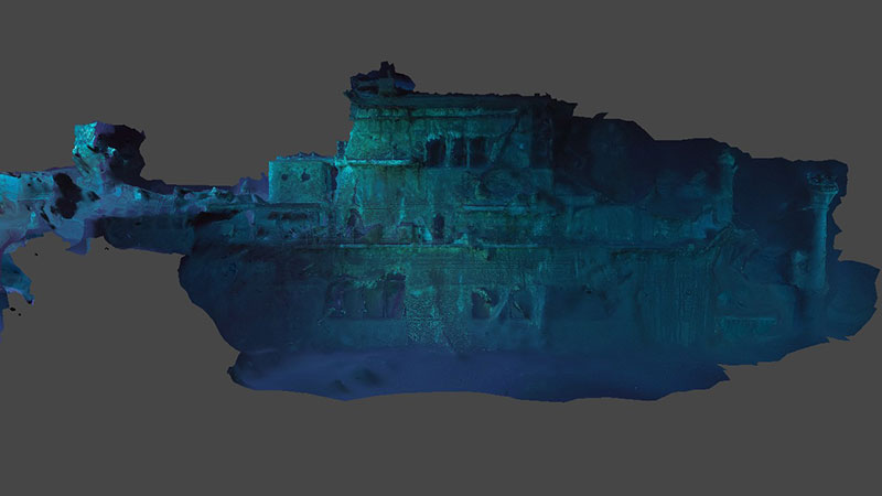
Photogrammetric model of the island of USS Yorktown, created by Raymond Phipps, NOAA Ocean Exploration explorer-in-training, March 30, 2024. The island is one of the areas of the ship targeted for exploration during the Beyond the Blue: Papahānaumokuākea ROV and Mapping expedition. Image courtesy of NOAA Ocean Exploration.
Jim is taking part in live dives (virtually from shore) via NOAA’s Okeanos Explorer on this fascinating mission.
The USS Yorktown (CV-5) was an aircraft carrier, sunk in the Battle of Midway during World War II. These new exploration dives are mapping the shipwreck and environment around the Papahānaumokuākea region.
While the wreck was first found by Dr. Robert Ballard in 1998, each subsequent expedition has led to more understanding of the wreck and its part in the history of war.
Jim says: “…dives like these not only add to the historical record, they also provide details and often a new understanding based on the physical evidence of the past. In a battle as intense as Midway, the fury and frenzy of the fight and the scale of death and destruction meant that not every aspect or detail of what happened is in the history books. These dives, once unimaginable, into the deepest parts of the ocean add to that record, as well as connecting postwar generations to those who fought this pivotal battle in a global war. The powerful images that we collect also connect us all to that special place and to those people who survived and those who did not.”